
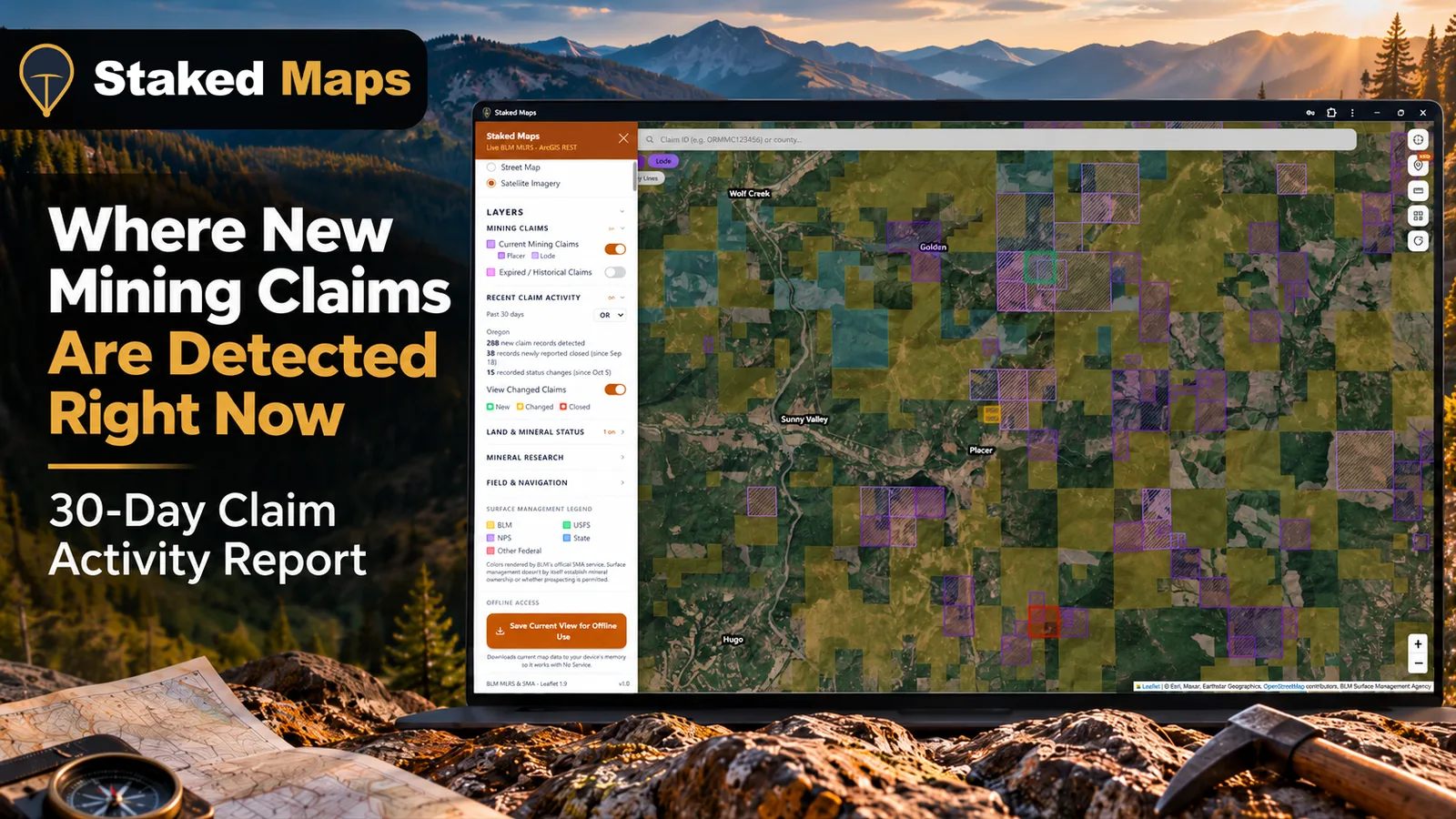
In the last 30 days, 5,567 new federal mining claim records appeared in the Bureau of Land Management's public claim data across the 13 Western states. Nevada had the most, with 2,373. But the state rankings hide the bigger pattern: most new claim records arrive in large blocks. In the first full month Staked Maps tracked (September 14, 2026 to October 13, 2026), just 14 claim groups of 100 or more records made up 3,415 of the 5,491 new records, or 62%. One group of 1,031 placer claims in western Juab County, Utah, was 19% of all new federal claim records in the West.
That matters if you use claim activity to decide where to research. A county can top the list because one company staked one big block, while scattered individual claims somewhere else barely register. This report shows where the activity is, how to tell a single block from broad interest, and what new records can and cannot tell you.
The numbers, tables and charts in this article update automatically from Staked Maps' claim database, so they always cover the most recent 30 days. Figures tied to specific dates describe that period and do not change.
"New" Means Newly Detected, Not Newly Staked
Every count in this report measures the same thing: a federal mining claim record appearing in BLM's public claim data for the first time. That is not the same as the date someone staked the claim, and the gap is large enough to matter.
A claim passes through several dates on its way into public data:
| Date | What happens | Can this report see it? |
|---|---|---|
| Date of location | The locator stakes the claim on the ground and posts the location notice. | No. BLM's public claim map data does not include it. |
| County recording | The locator records the notice with the county recorder. Federal rules allow up to 90 days after location, and some states require less. | No. |
| BLM recording | BLM's state office receives the claim and fees. Federal rules also allow up to 90 days. BLM labels a paid claim Submitted until its data is entered. | Indirectly, through status changes. |
| Data entry complete | BLM finishes entering the claim. Its status becomes Filed while it waits for land status review. | Yes, once it reaches the public map data. |
| First seen by Staked Maps | Staked Maps' nightly sync finds the record in BLM's public data for the first time. | Yes. This is what "new" means here. |
Under 43 CFR 3833.11, a claim must be recorded with BLM within 90 days of location, and BLM's recording guidance notes that some states require county filing within 30 or 60 days. Then BLM still has to enter the data. A claim that shows up in public data this month may have been staked weeks or months earlier.
There's a useful check on this. Only 68% of the last 30 days' new records carry a BLM serial number higher than any serial already in our data when tracking began on September 10, 2026. The rest had their serial numbers assigned earlier and simply reached public data during the window. That is why this report says "new claim records," never "newly filed claims."
The public data is still the most useful early signal available. It covers every Western state on the same terms, and it is where these claims first become visible to anyone checking a map.
The 30-Day Picture at a Glance
For the 30 days ending November 15, 2026:
- New federal claim records detected: 5,567
- Federal claim records newly reported closed: 2,137, counted only when BLM's own closed-claims layer confirms the closure
- Recorded status changes on existing claims: 2,859
- New Alaska state mining claim records (Alaska Department of Natural Resources, a separate state system): 52 (since November 10, 2026, when Alaska DNR case tracking began)
- Alaska state mining claims newly reported closed: 0 (since November 10, 2026, when Alaska DNR case tracking began), counted when a case leaves Alaska DNR's active claims layer and appears in its closed claims layer
Most new records are still early in BLM's process. Of the 5,567, 4,684 (84%) carry the status Filed, meaning BLM has entered them but has not finished land status review. Only 871 were already Active when they first appeared. Our guide to BLM mining claim statuses explains what each status does and does not tell you.
The status changes show the same pipeline from the other side. In the first tracking month, the largest group was Nevada claims moving from Submitted to Filed (885), followed by claims in several states moving from Filed to Active.
Which States Recorded the Most New Claims?
Nevada recorded the most new federal claim records over the last 30 days, with 2,373. Arizona, Utah, Alaska and California round out the top five.
| State | New claim records | Lode | Placer | Newly reported closed | Current federal claims | New as % of current |
|---|---|---|---|---|---|---|
| Nevada | 2,373 | 2,332 | 40 | 59 | 282,318 | 0.8% |
| Arizona | 1,162 | 777 | 385 | 1,720 | 65,303 | 1.8% |
| Utah | 755 | 668 | 87 | 0 | 44,973 | 1.7% |
| Alaska (federal) | 646 | 638 | 8 | 7 | 10,729 | 6.0% |
| California | 182 | 112 | 68 | 10 | 29,072 | 0.6% |
| Idaho | 166 | 117 | 49 | 12 | 41,726 | 0.4% |
| New Mexico | 115 | 74 | 40 | 10 | 14,614 | 0.8% |
| Oregon | 67 | 37 | 30 | 30 | 11,457 | 0.6% |
| Colorado | 52 | 31 | 21 | 271 | 14,865 | 0.3% |
| Montana | 28 | 21 | 7 | 9 | 20,712 | 0.1% |
| Washington | 11 | 11 | 0 | 6 | 2,634 | 0.4% |
| Wyoming | 10 | 1 | 9 | 3 | 49,402 | 0.02% |
| South Dakota | 0 | 0 | 0 | 0 | 9,156 | 0% |
"Current" means every federal claim not marked Closed, of any status. Tunnel site and mill site records count toward totals but not toward the lode or placer columns. Alaska figures here are federal claims only.
A big inventory doesn't mean big activity
The last column is the one most claim maps never show. The states with the most existing claims are not necessarily where new claims are appearing.
- Nevada has by far the most claims in the West, so its new records equal only 0.8% of the 282,318 claims already on its books. Nevada's volume mostly reflects how large its claim market already is.
- Wyoming holds one of the largest federal claim inventories in the West, 49,402 claims, yet recorded 10 new records in the last 30 days. Most of that inventory was located years ago.
- Alaska's federal claim inventory is small, so its 646 new federal records equal 6.0% of everything on file there. In the first tracking month, one large block explained most of Alaska's total (see below).
- Washington has the smallest inventory of the 13 states, and its 11 new records add up to 0.4% of it.
If you want to know where interest is growing, the percentage is a better guide than the raw count. If you want to know where competition for ground is heaviest overall, the inventory is the better guide. Our Nevada guide covers why so much of the West's claim inventory sits in one state.
The Counties With the Most New Claim Records
| County | State | New claim records | Lode | Placer | Largest single claim series |
|---|---|---|---|---|---|
| Nye County | Nevada | 799 | 797 | 1 | 552 |
| Carbon County | Utah | 458 | 458 | 0 | 458 |
| Humboldt County | Nevada | 336 | 335 | 1 | 154 |
| Yavapai County | Arizona | 326 | 275 | 51 | 213 |
| Gila County | Arizona | 311 | 311 | 0 | 306 |
| Pershing County | Nevada | 280 | 280 | 0 | 212 |
| Kenai Peninsula Borough | Alaska | 258 | 254 | 4 | 253 |
| Elko County | Nevada | 221 | 221 | 0 | 132 |
| La Paz County | Arizona | 221 | 15 | 206 | 172 |
| Juab County | Utah | 163 | 121 | 42 | 67 |
"Largest single claim series" is the biggest group of new records in that county sharing one claim-name prefix, such as ABC 1 through ABC 200. BLM's data doesn't yet include a mappable location for some new records, mostly in Montana. Those count toward state totals but not toward any county.
The last column tells you how to read the rest of the table. When the largest series is close to the county total, the county is on the list because of one block. When it is a small share, the activity is split across several separate series, which points to more than one party taking an interest in the area. In the first tracking month, Juab, Lander, Lake (Oregon) and Shoshone counties were single-block counties, while Elko and Mineral counties in Nevada had activity spread across several series.
Lode Claims Dominate, Except Where One Block Tips the Scale
Lode claims made up 87% of new federal claim records over the last 30 days, and placer claims made up 13%. A lode claim covers a vein or other mineral deposit in place, in hard rock. A placer claim covers loose deposits, such as gold in stream gravel, or other minerals that aren't in a vein. Federal rules cap a lode claim at 1,500 by 600 feet, about 20.66 acres, and an individual placer claim at 20 acres (43 CFR 3832.22).
In the first tracking month, Utah broke the pattern: 1,054 of its 1,121 new records were placer claims. That reflected one block. Almost all of those placer records belonged to the single Juab County series described below, so they say little about placer staking across the rest of Utah. California came closest to an even split (48 lode, 47 placer). That fits the state's long placer history, but under 100 records in a month is too small a sample to read much into.
Why Claims Show Up in Blocks
A single prospector working a creek might stake a handful of claims. A company exploring a deposit typically stakes dozens or hundreds of contiguous claims at once to cover the whole target and the ground around it. Each 20-acre claim is a separate record with its own serial number, so a 20,000-acre land position becomes roughly 1,000 records.
Those records also reach public data in batches as BLM works through them. During the first tracking month, the three busiest days delivered 725, 819 and 925 new records, while other days delivered fewer than 10. A spike on one day usually means one block was processed, not a sudden rush of staking.
This is why a county ranking without context can mislead. Large blocks tend to be company exploration. Scattered small groups are more often individual prospectors. The pattern of a county's activity tells you more than its total.
Three Places That Stood Out in the First Month
These are the areas where the first full tracking month (September 14, 2026 to October 13, 2026) showed something worth a closer look. The figures here are fixed to that period. New filings near a deposit do not prove the deposit is valuable, and nothing in BLM's public map data says why any claim was staked.
Western Juab County, Utah: one placer block, one fifth of the West's new records
Between September 28 and October 13, 2026, 1,031 placer claim records in a single name series appeared in western Juab County, covering about 20,400 acres. They sit below the east side of the Deep Creek Range, roughly 6 to 12 miles east of Ibapah Peak, the range's highest summit.
The ground here is old lakebed. Ice Age Lake Bonneville once covered much of western Utah, and its sediments along the Deep Creek Range were partly eroded from the range's granite. The USGS Mineral Resources Data System lists two "Lake Bonneville Sediments" mineral occurrences inside the block's footprint, recording thorium, zirconium, uranium, rare earth elements and titanium. Those records trace back to a 1979 USGS evaluation of the Deep Creek Mountains area and later USGS work on how uranium and other elements carry over from the granite into the sediment derived from it. An occurrence record means the minerals were found there, not that they exist in a quantity anyone could mine.
Why it matters to you: this one block is why Utah ranked second in new claim records in the first month, and why Utah's activity looked overwhelmingly placer. If you're researching Utah for recreational gold placer ground, this block says little about that. It is a large land position in a specific, unusual geologic setting. See Juab County mining claims for the county's full claim picture.
Quartz Mountain, Lake County, Oregon: watching the reporting lag happen
Between September 16 and September 28, 2026, a series of 199 lode claim records appeared in BLM's public data near Quartz Mountain in Lake County, along the Oregon Highway 140 corridor. Lake County had 203 new records in the first month, the most of any Oregon county.
Quartz Mountain is a known gold deposit. The USGS Mineral Resources Data System classifies it as a hot-spring gold and silver deposit hosted in volcanic rock. On August 19, 2026, Q-Gold Resources announced that it had staked new claims surrounding its existing Quartz Mountain claim block. BLM's public map data does not list claimants, so the map alone cannot confirm these are the same claims. The timing still shows how the process works: claims announced as staked in mid-August are the kind of records that appear in public data several weeks later.
Why it matters to you: a block next to a known deposit signals active company exploration, and the land around such a block is often the most heavily claimed in the area. That makes it a poor place to go looking for open ground. More on Oregon's claims on the Oregon mining claims page.
Nevada: the most activity, spread the widest
Nevada recorded 1,684 new claim records in the first month, spread across 12 of its counties, nearly all of them lode. No single block dominated the state the way one block dominated Utah. The largest Nevada series in the first month was 252 records just south of Gabbs in Nye County. Elko (365), Nye (321), Lander (227) and Pershing (211) counties each saw substantial activity.
Why it matters to you: Nevada's activity looks like what it is, a large and mature claim market where many separate parties keep staking. With new records adding only 0.8% to an inventory of 282,318 claims over the last 30 days, the practical question in Nevada is usually what ground is left between the existing claims. See Elko County, Nye County and Lander County.
Alaska's federal activity followed the Utah pattern: most of its 766 new federal records in the first month were one lode series west of Cook Inlet, in the Kenai Peninsula Borough. Alaska also has a separate state claim system, run by the Alaska Department of Natural Resources, on state land.
What Recent Claim Activity Can Tell a Prospector
Recent activity is a starting point for research. Used well, it can tell you:
- Where companies are spending money now. A large new block usually means an exploration program, which often follows geologic work you can read about.
- Which areas are changing. Ground that was open last year may be covered now, and older claims nearby may have been dropped.
- Where to look harder at land status. Activity clusters are exactly where an outdated map is most likely to steer you wrong.
It cannot tell you:
- That minerals are there in paying quantities. Claims are staked on hope and theory as often as on proof.
- That a claim is valid. Recording and paying fees do not make a claim valid. BLM's regulations say this directly (43 CFR 3833.1).
- That nearby land is open to staking. Gaps between claims can be private land, withdrawn land, or ground covered by claims that haven't reached public data yet.
How to Investigate an Activity Hotspot in Staked Maps
Here's how to take a county from this report and look at the actual ground.
1. Open the state and find the activity. In Staked Maps, open the Recent Claim Activity section of the map sidebar. It shows the past 30 days for the state you're viewing: new claim records, closures and status changes. These come from the same data as this report, for that state.
2. Turn on "View Changed Claims." This highlights the claims behind those numbers on the map. On the free plan you'll see newly detected claims highlighted in green, each with its "Newly detected" date, plus counts of changes and closures. Paid plans also highlight changed claims in yellow and closed claims in orange, and show a BLM Recorded Changes list for each changed claim, such as a status moving from Filed to Active.
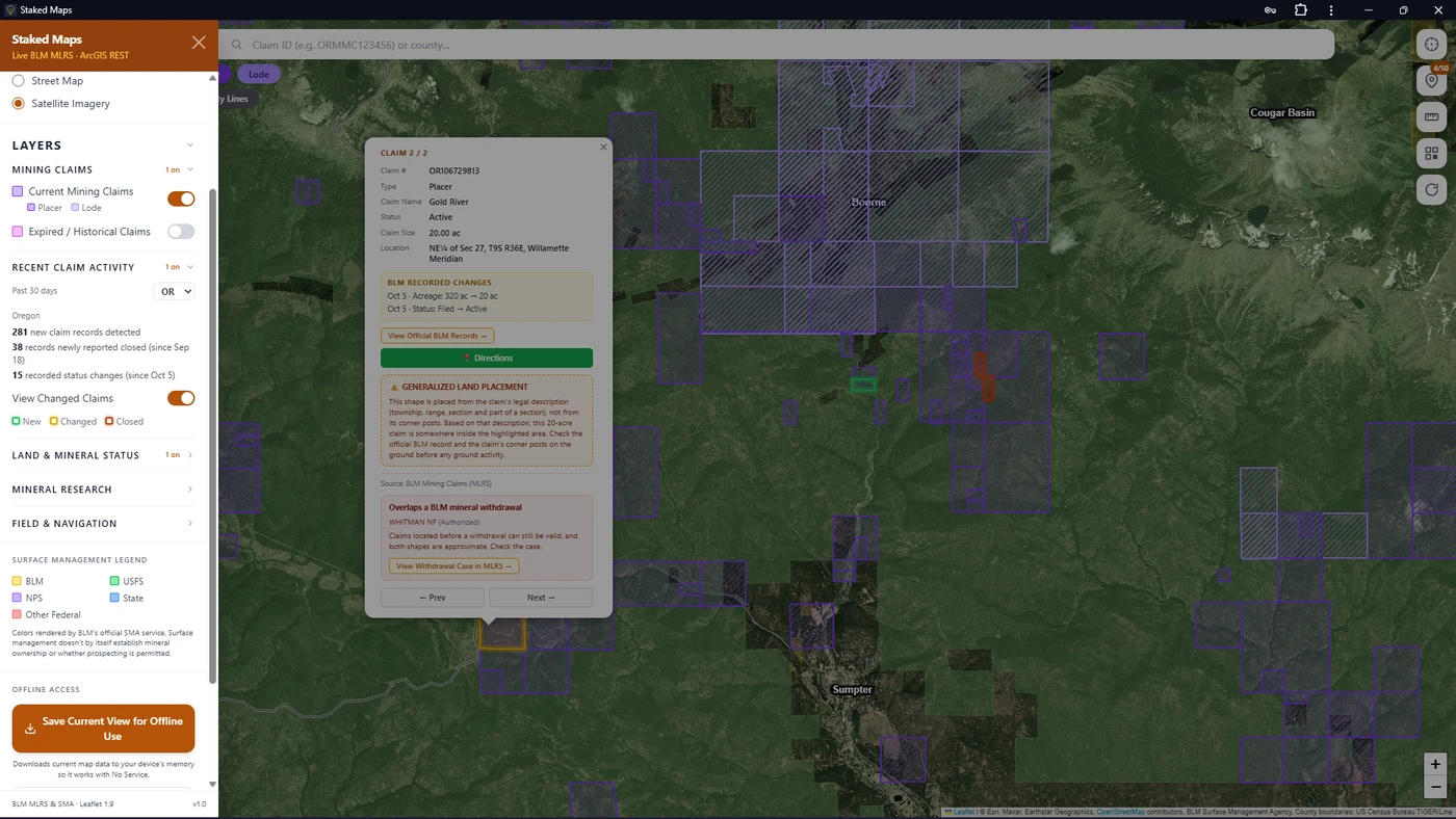
3. Read the block, not just the count. Zoom into the cluster. Click a few claims: if they share a name series and sit edge to edge, you're looking at one block. Check the claim type and status in each popup.
4. Check who manages the surface. Turn on the surface management layer (free) to see whether the ground around the block is BLM, Forest Service, state or private land. A gap between claims on private land is not open to federal claim staking.
5. Check for withdrawals. On paid plans, the BLM withdrawals layer shows land BLM records as withdrawn from mineral entry, where new claims generally cannot be located.
6. Confirm with BLM. On paid plans, each claim popup shows the serial number and a View Official BLM Records button that opens the claim's record in BLM's public MLRS reports. That record lists case actions and payment history, which the map can't. Alaska's federal claim records are kept in BLM's Alaska system, not MLRS.
See the Last 30 Days of Claim Activity in Your State
Staked Maps highlights newly detected mining claims on the map for your state, free. Paid plans add changed and closed claims, BLM recorded changes, official-record links and research layers.
View Recent Claims FreeNo credit card required.
What This Data Can't Tell Us
- Exact staking or filing dates. BLM's public map data has no location or filing date field. "New" means first detected.
- Claims still in BLM's queue. Claims BLM has received but not yet published don't appear until they do. The most recent activity is always undercounted.
- Claims with no mapped location. BLM's data doesn't yet include a usable location for some new records, so they count toward state totals but not toward any county.
- Exact boundaries. Claim shapes come from BLM's land descriptions, usually down to parts of a section. They're not surveyed boundaries.
- Multi-county claims. A claim that crosses a county line is counted in the county holding most of its area.
- Closures with a lag. Closures count only after BLM's closed-claims layer confirms them, so they trail the actual closure.
- Long-term trends. Tracking began September 10, 2026, so the first complete 30-day period ended in mid-October. One or two months of data is not a trend.
- Who staked the claims. Claimant names are in BLM's case records, not the public map data this report uses.
Quick Answers About New Claims
How can I see new mining claims near me?
Open your state in Staked Maps and turn on View Changed Claims in the Recent Claim Activity section. Newly detected claims are highlighted on the map for free. You can also look up any claim in BLM's MLRS reports by its serial number.
How often does BLM update its mining claim data?
BLM updates its public mining claim data on its own schedule, and claims appear only after BLM enters them. Staked Maps checks BLM's data every night, so a claim usually shows up in Staked Maps within a day of reaching BLM's public data.
If a big block of new claims appears, should I stake next to it?
Not without research. The ground next to a large new block is often covered by the same company's claims, some of which may not have reached public data yet. Check surface management, withdrawals and BLM's records first. Staking over an existing valid claim generally gives you no rights against the earlier claim.
Does a new claim mean someone found gold?
No. A new claim means someone paid to hold the right to explore that ground. Many claims are staked on geology that has not been proven.
Reading the Map Behind the Numbers
The habit worth taking from this report is asking what sits behind a number: one block or many groups, a lode deposit or a placer setting, a large inventory or a small one. A month of claim activity is a signal. It points you toward places worth researching and tells you where land status is most likely to have changed since you last looked. The ground itself still has to be checked: who manages it, whether it's withdrawn, and what BLM's own records say about the claims around it.
Research the Ground Behind the Activity
Map current federal mining claims, recent claim activity and surface management in one place. Start free in one state, then unlock full claim details and research layers when you need them.
Start Mapping FreeNo credit card required.
Staked Maps provides mapping and research information, not a legal determination that land is open to prospecting or claim location. Always verify current claim records, land status and applicable rules with the appropriate government agencies.
Methodology: How the Counts Are Made
- Source: BLM's public national mining claims map service (MLRS mining claims layers), synced by Staked Maps every night. Alaska state claims come from the Alaska Department of Natural Resources' public mining claims service and are reported separately.
- Window: the most recent 30 days, recalculated automatically. Figures tied to specific dates describe the first full tracking month, September 14, 2026 to October 13, 2026 (Pacific time).
- New claim records: federal claim records first seen by Staked Maps during the window, counted once per record. Records later closed still count as new for the period they appeared in.
- Closures: records whose closure Staked Maps confirmed in BLM's closed-claims layer during the window, from September 18, 2026 onward. A one-time catch-up of older closures on September 17 is excluded.
- Status changes: changes to a record's BLM case status, logged from October 5, 2026.
- Lode and placer: BLM's claim type codes. Tunnel sites and mill sites are counted in totals only.
- Counties: assigned from the claim's mapped shape, by the county holding most of its area. Records with no mapped location are counted in state totals only.
- Claim series and blocks: records in the same state sharing a claim-name prefix followed by a number. A block is a series of 100 or more. This is an approximation, and two unrelated parties can occasionally use the same prefix.
- Excluded: Rockhound Hotspots and other non-claim data, and states outside the 13 Western states Staked Maps covers.
This report's regulatory and agency information was checked against current BLM regulations and guidance as of October 14, 2026. Its statistics update automatically.
Sources
- 43 CFR Part 3833: Recording mining claims and sites, Electronic Code of Federal Regulations
- 43 CFR Part 3832: Locating mining claims and sites, including size limits, Electronic Code of Federal Regulations
- Recording a Mining Claim or Site, Bureau of Land Management
- BLM MLRS public reports, Bureau of Land Management
- Mineral Resources Data System, U.S. Geological Survey
- Cadigan, R.A., and others, 1979, Evaluation of the potential for uranium and other mineral resources in the Deep Creek Mountains withdrawal area, Juab County, Utah, USGS Open-File Report 79-1304
- Q-Gold Successfully Completes Expansion of Mineral Claim Position at Quartz Mountain Gold Project, Oregon, Q-Gold Resources press release, August 19, 2026
- Staked Maps claim database, derived from BLM and Alaska DNR public data