
Juab County, UT Mining Claims & Land Ownership Map
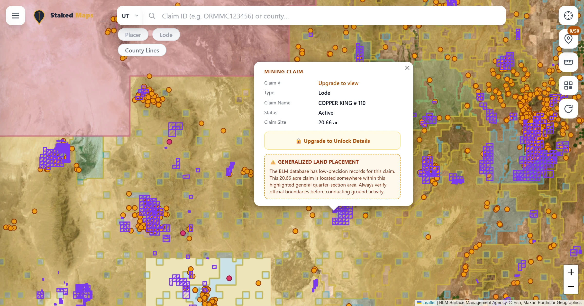
Current BLM claim data, land ownership layers, and rockhounding-ready backcountry navigation for Juab County, UT — built for the field.
Juab County, UT Mining Claims & Land Ownership Map
Current BLM claim data, land ownership layers, and rockhounding-ready backcountry navigation for Juab County, UT — built for the field.
Juab County sits at the absolute center of Utah rockhounding and historic silver-gold mining, spanning from the West Tintic Mountains out across the arid Thomas and Dugway ranges. Globally famous for Topaz Mountain, the Dugway Geode Beds, and the legendary Tintic Mining District around Eureka, the county draws crystal hunters, gold panners, and metal detectorists year-round. Public domain lands managed by the BLM Fillmore and Salt Lake field offices offer expansive desert territory for casual collecting and prospecting.
Geologically, Juab County features a dynamic volcanic and structural environment. Mid-Tertiary rhyolitic eruptive centers deposited topaz, bixbyite, pseudobrookite, and red beryl within gas cavities of the Thomas Range Rhyolite. To the west, Miocene volcanic geodes were eroded and concentrated by Pleistocene Lake Bonneville in the Dugway basin. Meanwhile, hydrothermal fluids injected rich silver, lead, gold, and copper replacement ores into faulted Paleozoic limestones across the Tintic district.
Navigating Juab County prospecting demands strict boundary awareness. Active unpatented lode and placer claims blanket historic mining slopes and fee-dig gem sites, interlocking with private patented property and state trust land. Referencing an active Juab County mining claims map enables rockhounds and prospectors to verify live federal BLM MLRS records, confirm open public domain ground, and explore backcountry desert ranges with complete confidence.
2,964
Current / Not-Closed Juab County, UT Claim Records
38,161
Historical Juab County, UT Claims
367
Juab County, UT Rockhound Hotspots
41,492
Total Juab County, UT Claims & Hotspots
364
Metallic Sites
3
Non-Metallic Sites
Notable finds: Gemstone
| Material | Sites Recorded |
|---|---|
| Gemstone | 2 |
2,414
Lode Claims
549
Placer Claims
| Claim Type | Current Claims |
|---|---|
| Lode Claims | 2,414 (81.5%) |
| Placer Claims | 549 (18.5%) |
View Free Version · Premium Plans
Save any map area while you have cell service, then navigate active BLM mining claims, surface-management boundaries, and optional layers like elevation contours, roads, and creeks — with zero connectivity out in the field. Offline downloads are included on every paid plan. See plans below →
Official Prospecting Resources for Juab County, UT
Plans
Basic
Try Staked Maps in one state.
$0/mo
Paid plans unlock full claim details, historical claims, research layers and offline tools.
Get Started FreeLocal Miner
For prospectors who mostly work one state.
$29.99/yr
Everything in Free, plus:
Adventure Miner
For prospectors who cross nearby state lines.
$49.99/yr
Everything in Free, plus:
Pro Prospector
For serious Western prospectors.
$99.99/yr
Everything in Free, plus:
Just here to rockhound?
Rockhound Enthusiast
For nationwide rockhounding research.
$29.99/yr
Gem & crystal hunters, Midwest/East users — everything in Free, plus:
Single State, Tri-State and All-West all unlock the exact same features — nothing is pay-gated between them, they differ only in how many states you get.
Paid plans renew automatically at the monthly or annual rate you choose until you cancel. Cancel anytime and keep access through the end of your paid period. See our Terms of Use.
Staked Maps isn't crowd-sourced guesswork. Current and historical claim boundaries are parsed directly from the Bureau of Land Management's Mineral & Land Records System (MLRS), which replaced the legacy LR2000 mining claim system in 2021, and kept in sync with our database on a regular schedule. Rockhound Hotspots draw from the USGS Mineral Resources Data System (MRDS), cross-referenced by material so you can see exactly what's been found at a given site. For legal filings, always confirm current status directly with your BLM state office of record; Staked Maps is a research and navigation tool, not a substitute for the official record.
Directly from the Bureau of Land Management's official MLRS (Mineral & Land Records System) case-recordation records, synced into our database on a regular schedule — not scraped or crowd-sourced.
Staked Maps displays the status reported by BLM. Records with a case disposition of Active are labeled Active; historical records come from BLM's closed-claims dataset. These statuses are research information, not a Staked Maps legal determination of claim validity, discovery, ownership or compliance. Verify the current record through MLRS before acting on it.
Free users can search by county. Paid plans add search by claim serial number, plus each claim's full legal (aliquot) description and BLM records link.
Staked Maps currently tracks 2,964 current federal mining claim/site records and 38,161 historical claim records from BLM MLRS, plus 367 Juab County, UT mineral-occurrence records derived from USGS MRDS.
A premium map layer of documented mineral occurrences, prospects and mines sourced from USGS MRDS and labeled by material where available. These records are research leads, not a directory of verified public collecting sites.
Yes — the live map covers all of Utah, not just Juab County. Other Utah counties with a dedicated page: Beaver County, Tooele County, Millard County and Iron County.
Juab County Recorder Office is Juab County, UT's primary office for filing and researching mining claims — see the Official Filing & Information Links section above for the direct link and more resources.
Regulatory and editorial content last reviewed against official records · Source: Juab County Recorder Office · USGS MRDS
Information hosted on Staked Maps is compiled from publicly available data streams provided by the Bureau of Land Management (BLM) and relevant state geographic clearinghouses. Staked Maps accepts no liability for the content of this geospatial data, or for the consequences of any real-world exploration, land entry, or staking actions taken on the basis of the information provided via this application interface.
Staked Maps makes no warranty, expressed or implied, including the warranties of merchantability and fitness for a particular purpose, nor assumes any legal liability or responsibility for the pinpoint accuracy, reliability, completeness, latency, or programmatic utility of these geospatial data layers, or for the improper interpretation of these data grids.
These mapping layers and related graphics are visual convenience aids only; they are not legal documents and must never be used as such. The data may not be used to legally determine title, mineral ownership, valid description boundaries, jurisdictional authorities, or land restrictions in place on public or private land. Natural backcountry hazards may or may not be depicted on topographies, and land users are strictly mandated to exercise caution. Federal records are dynamic and change constantly. The end-user is exclusively responsible for validating current land classifications with local BLM field offices and managing compliance accordingly.