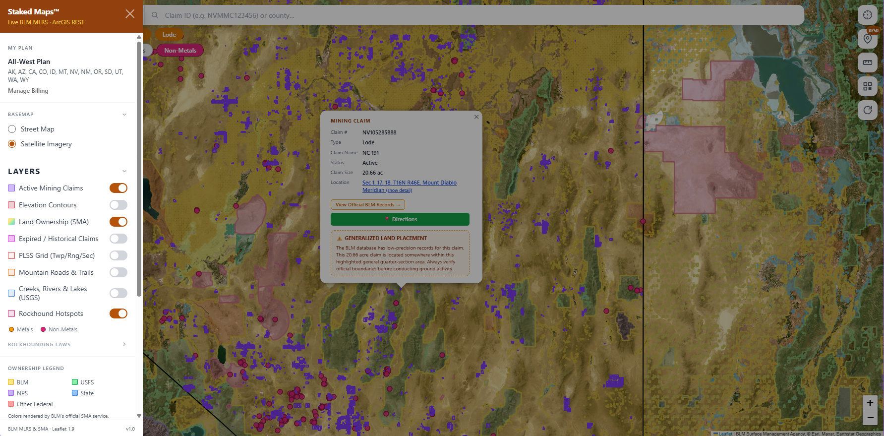
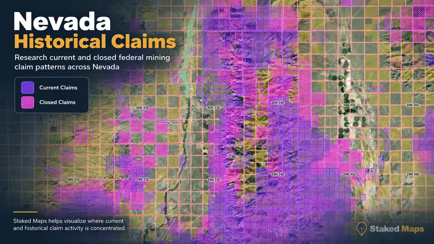
Nevada has 278,666 current federal mining claim and site records in the Staked Maps database as of September 22, 2026. Of those, BLM currently labels 212,313 Active; the remainder are Filed, On Appeal, Submitted or Under Review. Staked Maps combines BLM claim records with surface-management and field-navigation layers so you can research an area before heading into the field.
A mapped gap between current claims does not automatically mean the ground is open for prospecting or claim location. Land ownership, mineral ownership, withdrawals, existing rights, access restrictions and other land-status rules still need to be verified.
Free account · No credit card required · Opens directly to the Nevada map
Nevada Has BLM's Largest Mining Program
BLM reports more than 270,000 active mining claims in Nevada, representing about 47% of the agency's active mining claims nationwide. That concentration makes Nevada fundamentally different from most Western states: claim research is often less about finding whether mining has occurred nearby and more about understanding exactly what has been recorded, where records overlap your area of interest, and what the underlying land and mineral status allows.
What does "current / not-closed" mean? Staked Maps uses BLM MLRS records whose case disposition is not closed as of the latest synchronization. A current record is not, by itself, a legal determination that a mining claim is valid, that a discovery has been established, or that every filing requirement has been satisfied.
"Current / not-closed" records include every BLM case disposition that isn't Closed, not only claims BLM itself labels "Active." Here's the actual breakdown:
BLM Status
Records
Active
212,313
Filed
61,947
Under Review
3,369
On Appeal
1
Submitted
1,036
Filed and Under Review records have a pending BLM case action and shouldn't be treated as identical to a fully Active claim. Verify a specific claim's exact status through BLM MLRS before relying on it.
See where Nevada's current claim records are located
Open the free Nevada map to inspect recorded claims alongside surface-management boundaries.
The table shows Nevada's five counties with the most current records. Separately, 682 records in the statewide total cannot currently be assigned to a specific county because their BLM source geometry is incomplete or unresolved.
Nye County currently contains the largest share of Nevada's mapped current claim/site records, followed by Elko County and Lander County. Together, Nye County, Elko County and Lander County account for 39% of the statewide total. Lode records make up 89.5% of current claims statewide and placer records 8.2%, with the remaining 2.3% recorded as tunnel or mill sites. Elko County has the most lode records and Nye County has the most placer records. Claim density alone does not establish mineral potential or whether nearby ground is open to location, but it provides a useful starting point for researching where mining activity is concentrated.
Remaining Nevada Counties With Current Mining Claim Records
Nevada's extraordinary concentration of lode claims reflects one of the world's major gold-mining regions. Large claim concentrations occur around mineralized trends and districts including the Carlin, Cortez and other north-central Nevada gold systems. USGS describes the Carlin-area deposits as part of one of the largest gold endowments on Earth, and Nevada remained the leading U.S. gold-producing state in 2025.
USGS's 2026 Mineral Commodity Summaries estimates Nevada produced about 64% of U.S. mine gold in 2025.
For prospectors, the practical result is visible on the map: many of Nevada's best-known mineral belts are also among its most densely claimed areas. Historical mineralization alone does not indicate that ground is currently available.
Lithium: Nevada's Brines and Clay Deposits
Nevada's modern mineral story is not limited to gold. Lithium occurs in several geological settings in the Great Basin, including basin brines and lithium-bearing clay deposits. Clayton Valley has supported lithium-brine production for decades, while the McDermitt Caldera area contains major lithium-bearing clay resources.
USGS specifically describes Great Basin lithium in brines and clays, including Clayton Valley and McDermitt.
BLM reported in February 2026 that the Silver Peak operation in Esmeralda County remained the only producing lithium mine in the United States.
Public Land Does Not Automatically Mean Open to Mining Claims
BLM manages nearly 48 million acres of public land in Nevada, about 63% of the state's land base. But surface management, federal ownership, mineral ownership and whether land is open to mineral entry are separate questions. A parcel can appear to be federally managed and still be withdrawn or otherwise unavailable for a new mining claim.
Under federal mining law, claims may generally be located only on federal mineral estate that is open to mineral entry. National parks, many wilderness areas, military reservations, wildlife areas and other withdrawn lands can be closed to new mining claim location. Always verify current mineral status and restrictions before staking or conducting fieldwork.
Surface ownership is not mineral status.
Seeing BLM or USFS land on a map does not, by itself, establish that the mineral estate is federally owned or that the land is open to new claim location.
Why Land Withdrawals Matter in Nevada
Nevada has extensive federal land and an unusually active mining sector, so proposed and existing land withdrawals can materially affect mineral-entry research. The Nevada Division of Minerals maintains information on land-use planning and proposed withdrawals that may affect mineral access.
Research counties and historic mining areas before a trip.
Navigate saved map areas in the field with applicable paid features.
Cannot by itself
Prove that land is legally open to mineral entry.
Establish mineral ownership or legal title.
Guarantee that every mapped boundary is survey-grade.
Give permission to cross private property.
Give permission to prospect on someone else's valid mining claim.
Replace current BLM, USFS, state or county records.
Determine which mining or in-stream activities require permits.
Use Staked Maps as a research and navigation tool, then confirm legal status with the agencies that manage the land and mineral estate.
What Do the Mapped Claim Boundaries Actually Mean?
Mining-claim maps are research tools, not boundary surveys. BLM's public MLRS geometries are generated largely from legal land descriptions and PLSS information, and public mapping may identify affected quarter sections rather than the exact claim boundaries staked and monumented on the ground.
Staked Maps therefore treats mapped claim polygons as interpreted research geometry. For legal boundary, title or filing decisions, review the official BLM case record, recorded location documents and field monuments.
How to Research a Nevada Prospecting Area
Check current recorded claim activity. Start by viewing current/not-closed claim and site records around the area you are researching. Dense claim activity is an immediate signal that additional record review is needed.
Check surface management and mineral-entry restrictions. Identify who manages the surface, then separately verify mineral ownership, withdrawals and whether the land is open to mineral entry. A surface-management layer alone cannot answer that question.
Verify the official record before acting. Open the underlying BLM record, review the legal location information and confirm current conditions through the appropriate agency and county records before staking or relying on a mapped boundary. BLM also advises prospectors to check existing claim markings in the field.
What it is: Geologic maps, mining-district publications, mineral resources and Nevada geological research.
Nevada Mineral Occurrences & Rockhounding Research
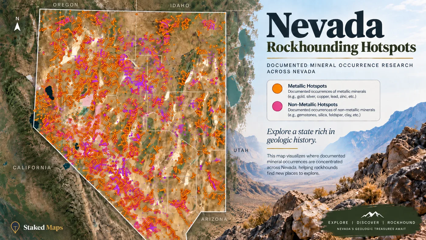
Staked Maps Rockhound Hotspots are derived from documented USGS mineral occurrences, prospects and mines. They are research leads, not a directory of places where collecting is automatically legal or currently permitted. Always confirm land ownership, claim status and collecting rules before visiting a site.
Source records sometimes use broad or overlapping commodity labels; counts above preserve the underlying record classifications.
Nevada Top Rockhounding Materials, Visualized
Material
Sites Recorded
Gemstone
215
Gemstone, Semiprecious
37
Quartz
16
Kyanite
11
Abrasive, Garnet
6
Perlite
2
Nevada Mining Context: From Comstock to Modern Gold and Lithium
Nevada's mining identity began with the Comstock Lode, discovered near Virginia City in 1859. The silver and gold strike triggered the state's first major mining boom, drew tens of thousands of prospectors and miners into the Nevada Territory, and helped establish the mining-law and county-recording practices Nevada claim research still relies on today.
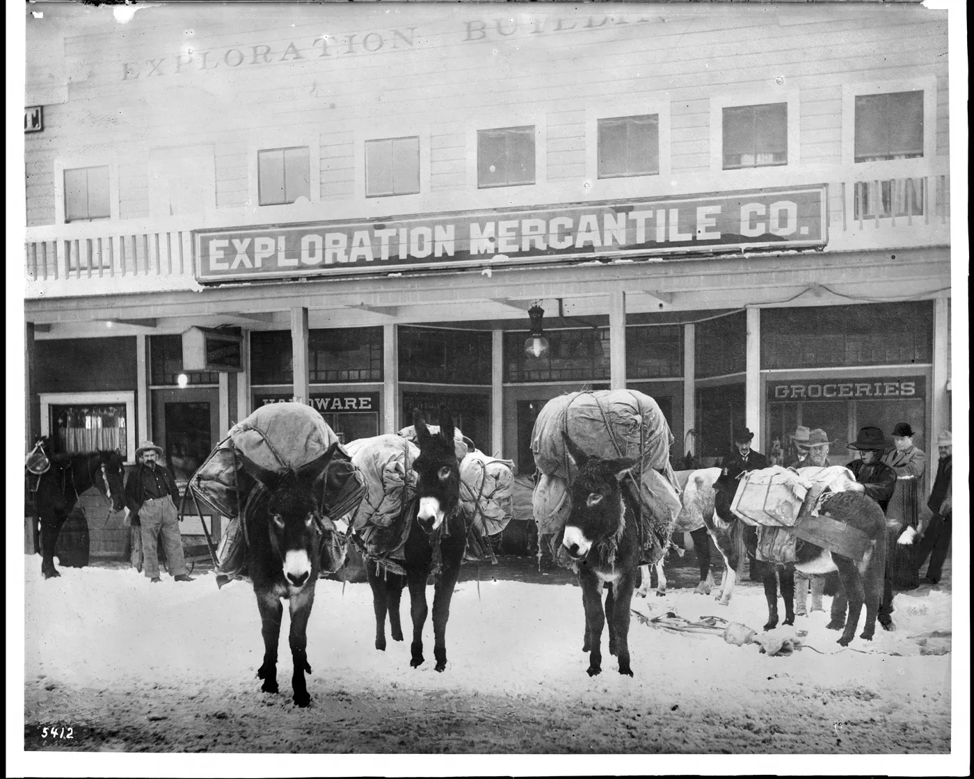
Historical mining photograph. Wikimedia Commons, Public Domain. Miner's pack animals in front of mining supply stores, Goldfield, Nevada, ca.1900. Call number: CHS-5412. Photographer: Pierce, C.C. (Charles C.), 1861-1946.
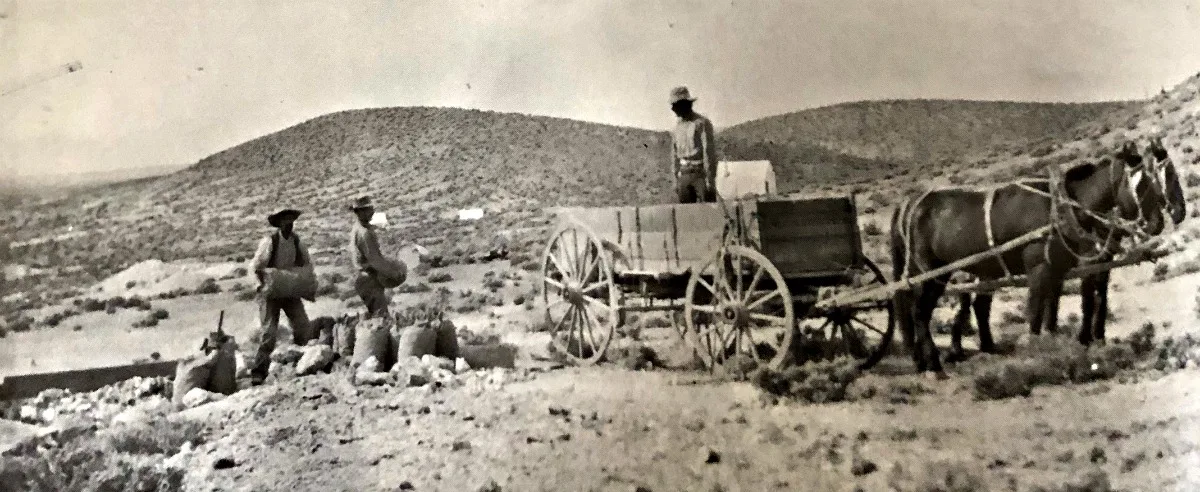
Later booms followed the same pattern: a strike drew claims, claims drew infrastructure, and infrastructure outlasted the original ore body. Goldfield and Tonopah anchored a second wave of central Nevada silver and gold mining in the early 1900s, and smaller districts like Broken Hills, in the state's mineral-rich central belt, supplied ore to the same rail-dependent shipping network.
Historical mining print. Wikimedia Commons, Public Domain. Broken Hills, Nevada, c. 1915. Ore sacks being loaded for shipment to the railroad at Fallon. Stanley W. Paher, Nevada Ghost Towns and Mining Camps (1970), p. 377, courtesy of Western History Research Center, University of Wyoming.
Modern Nevada mining is dominated by a different discovery: Carlin-type gold. Beginning in the 1960s, geologists recognized that north-central Nevada's Carlin, Cortez and Getchell trends held large, low-grade, disseminated gold deposits invisible to the naked eye — a fundamentally different target than the visible-vein lode mining of the Comstock era. The development of Nevada's Carlin-type gold systems helps explain why modern claim activity in north-central Nevada is so heavily lode-dominated.
Lithium is Nevada's newest chapter. Clayton Valley's brine operation has run for decades, and the McDermitt Caldera's lithium-clay resources and the Silver Peak operation in Esmeralda County keep Nevada at the center of the country's lithium supply conversation. Nevada's modern claim landscape reflects multiple generations of mineral development, from historic silver and gold districts to Carlin-type gold systems and newer lithium exploration.
Staked Maps' historical claim layer showing closed federal records alongside current claims.
How Do You View Nevada BLM Mining Claims Offline?
Save any map area while you have cell service, then navigate active BLM mining claims, surface-management boundaries, and optional layers like elevation contours, roads, and creeks — with zero connectivity out in the field. Offline downloads are included on every paid plan. See plans below →
What Premium Adds to Your Nevada Map
Historical Claims. See where mining activity existed before today's current records.
Full Claim Details. Serial number, legal location and a direct BLM record link.
Research Layers. PLSS, roads/trails, waterways and Nevada mineral occurrences.
Offline Maps. Save your Nevada research before losing cell service.
Field Tools. Directions, custom pins, measurements and claim-drafting tools.
Single State unlocks all premium features for Nevada for $29.99/year.
Plans
Choose Your Plan
Basic
Free
Try Staked Maps in one state.
$0/mo
✓Interactive mining claims map — pick your state (or use your location)
✓Surface management overlays & current mining claims
✓Claim type, name, status & size in claim popups
Paid plans unlock full claim details, historical claims, research layers and offline tools.
Single State, Tri-State and All-West all unlock the exact same features — nothing is pay-gated between them, they differ only in how many states you get.
Paid plans renew automatically at the monthly or annual rate you choose until you cancel. Cancel anytime and keep access through the end of your paid period. See our Terms of Use.
Single State, Tri-State and All-West unlock the identical feature set — only the number of states differs.
National Rockhound Pass is a separate, nationwide-but-lighter product built for rockhounds outside the core mining states.
Free
Single State
Tri-State
All-West
Rockhound Pass
Geographic coverage
1 state (view only)
1 state, full data
3 states, full data
13 Western states, full data
All 50 states, safety layer only
Interactive claims map, basemaps, compass, county search
✓
✓
✓
✓
✓
Surface management (public/private land) overlay
✓
✓
✓
✓
✓
Claim type, name, status & size in popups
✓
✓
✓
✓
✓
Full legal location (aliquot description)
✕
✓
✓
✓
✕
Claim serial number, owner intel, BLM Records & 'Directions' button
✕
✓
✓
✓
✕
Search by claim number
✕
✓
✓
✓
✕
Custom pins & distance measure tool
✕
✓ (up to 50)
✓ (up to 50)
✓ (up to 50)
✓
Expired & historical claims layer
✕
✓
✓
✓
✕
Placer/Lode claim filters & latest synchronized data
How Staked Maps Calculates Nevada Mining Claim Data
Current records: BLM MLRS mining claim and site cases whose disposition is not Closed, with individual BLM statuses preserved.
Historical records: Closed federal mining-claim records from BLM MLRS.
County statistics: Claim geometries are spatially assigned to Nevada counties where the BLM source geometry allows; records that cannot be reliably assigned are reported separately rather than forced into a county.
Claim geometry: Mapped research geometry is derived from BLM legal land descriptions and PLSS information and should not be treated as survey-grade boundaries.
Mineral occurrences: Nevada Rockhound Hotspots use USGS MRDS records of documented occurrences, prospects and mines.
Update schedule: Claim records sync nightly, with a full reconciliation sweep every Tuesday and a full historical-records cross-check against BLM's closed-claims layer on the 28th of each month.
Nevada Data Sources & Methodology
BLM MLRS — Current and historical federal mining claim and site records.
USGS MRDS — Documented mineral occurrences, mines and prospects used for mineral research layers.
Nevada Division of Minerals — Nevada-specific mining claim guidance, filing information and land-use resources.
Directly from the Bureau of Land Management's official MLRS (Mineral & Land Records System) case-recordation records, synced into our database on a regular schedule — not scraped or crowd-sourced.
What's the difference between active and historical claims?
Staked Maps displays the status reported by BLM. Records with a case disposition of Active are labeled Active; historical records come from BLM's closed-claims dataset. These statuses are research information, not a Staked Maps legal determination of claim validity, discovery, ownership or compliance. Verify the current record through MLRS before acting on it.
Can I search by claim number?
Free users can search by county. Paid plans add search by claim serial number, plus each claim's full legal (aliquot) description and BLM records link.
How many active mining claims are in Nevada?
As of September 22, 2026, BLM records in Staked Maps show 212,313 Nevada mining claim and site records with a case disposition of Active. Another 61,947 are Filed, 1 is On Appeal, 1,036 are Submitted and 3,369 are Under Review, bringing Nevada's total current/not-closed federal claim and site records to 278,666. These database statuses are not a legal determination that an individual claim contains a valid mineral discovery.
What are Rockhound Hotspots?
A premium map layer of documented mineral occurrences, prospects and mines sourced from USGS MRDS and labeled by material where available. These records are research leads, not a directory of verified public collecting sites.
Where are most mining claims in Nevada?
Nevada's current federal mining-claim records are concentrated in a handful of counties. As of the data date above, Nye County ranks first, followed by Elko County and Lander County. Together, those counties account for about 39% of Nevada's current mapped claim/site records. Claim concentration indicates recorded mining activity, not whether adjacent land is open for prospecting or whether it has mineral potential.
Does the Nevada map cover the whole state?
Yes. Staked Maps covers Nevada statewide. Dedicated research pages are currently available for Elko County, Nye County, Humboldt County, Lander County and Mineral County, while the interactive map covers claims and surface management throughout Nevada.
Which agency manages federal mining claims in Nevada?
The Bureau of Land Management Nevada State Office administers federal mining-claim records for Nevada. Nevada also has county recording requirements — new claims are generally filed with both the county recorder and BLM. See the Official Nevada Mining Claim Research & Filing Resources section above for direct links.
Why does Staked Maps say "current / not-closed" instead of "active"?
BLM's national MLRS geospatial dataset defines these records as mining claim cases with a disposition other than closed. Staked Maps uses that terminology to avoid implying that a database status alone establishes legal claim validity.
Does BLM land mean I can stake a mining claim there?
No. Surface management and mineral-entry status are different. Federal land may be withdrawn from mineral entry, may have a different mineral estate, or may be subject to other restrictions. Verify current land and mineral status before locating a claim.
Are Staked Maps claim polygons exact legal boundaries?
No. They are research geometry based on recorded location information. BLM notes that public MLRS mapping commonly relies on legal land descriptions and PLSS mapping and may show affected quarter sections rather than exact staked boundaries. Review the official case file and location documents for legal research.
Where are Nevada mining claims filed?
Federal mining-claim records are filed with the Bureau of Land Management, and Nevada also has county recording requirements. Consult the Nevada Division of Minerals, the appropriate county recorder and BLM for current requirements before filing.
What is the difference between a lode claim and a placer claim?
Lode claims generally cover mineral deposits in rock in place, while placer claims apply to other forms of locatable mineral deposits. Mill and tunnel sites serve different purposes under federal mining law and shouldn't be counted as lode or placer claims. BLM separately recognizes lode claims, placer claims, mill sites and tunnel sites.
Does Staked Maps work offline in Nevada?
Yes. Save any Nevada map area while you have cell service, then view current and historical claim records, surface-management boundaries and optional layers with zero connectivity in the field. Offline downloads are included on every paid plan.
Information hosted on Staked Maps is compiled from publicly available data
streams provided by the Bureau of Land Management (BLM) and relevant state
geographic clearinghouses. Staked Maps accepts no liability for the content of
this geospatial data, or for the consequences of any real-world exploration,
land entry, or staking actions taken on the basis of the information provided
via this application interface.
Staked Maps makes no warranty, expressed or implied, including the warranties of
merchantability and fitness for a particular purpose, nor assumes any legal
liability or responsibility for the pinpoint accuracy, reliability, completeness,
latency, or programmatic utility of these geospatial data layers, or for the
improper interpretation of these data grids.
These mapping layers and related graphics are visual convenience aids only; they
are not legal documents and must never be used as such. The data may not be used
to legally determine title, mineral ownership, valid description boundaries,
jurisdictional authorities, or land restrictions in place on public or private
land. Natural backcountry hazards may or may not be depicted on topographies, and
land users are strictly mandated to exercise caution. Federal records are dynamic
and change constantly. The end-user is exclusively responsible for validating
current land classifications with local BLM field offices and managing compliance
accordingly.