Idaho Mining Claims Map: Current Claims, Land Status & Prospecting Rules
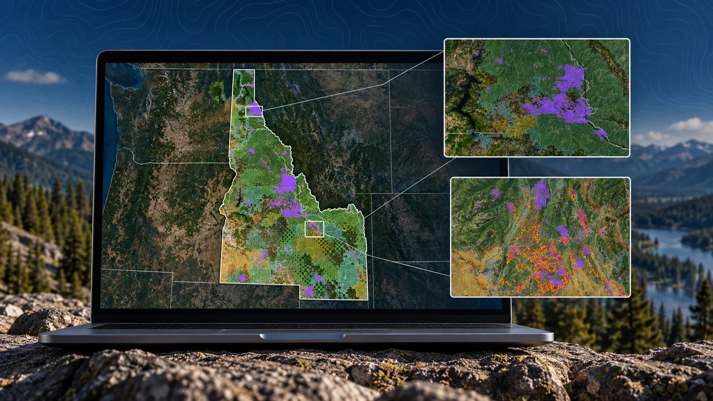
Research Idaho federal mining claims alongside historical claim activity, surface-management layers and mineral-occurrence records. Staked Maps combines federal datasets with field-oriented mapping tools so you can investigate an area before heading out.
A mapped gap between current claims does not automatically mean the ground is open for prospecting or claim location. Land ownership, mineral ownership, withdrawals, existing rights and access restrictions still need to be verified.
Free account · No credit card required · Opens directly to the Idaho map
Idaho Mining Claims at a Glance
41,306
Current / Not-Closed Federal Claim & Site Records
218,535
Historical Claim Records
7,243
Rockhound / Mineral Records
Mining claim data synchronized: . Records sync from BLM on a regular schedule, not live with every visit.
What Idaho's Current Mining Claim Data Shows
Staked Maps currently tracks 41,306 current/not-closed federal mining claim and site records in Idaho. "Current" means the BLM case disposition is not Closed as of the latest synchronization; "historical" refers to BLM's separate closed-claims dataset, discussed later on this page.
Idaho's current records are not spread evenly across the state, but which counties lead depends on how you count. BLM's own status field distinguishes an Active claim from one that is only Filed or otherwise pending, and current/not-closed and Active-specific rankings can put a different county in second place. The next section ranks Idaho's counties by BLM-status Active records specifically; the fuller current/not-closed county breakdown, including the same counties' Filed and Under Review shares, follows further down this page.
By claim/site type, lode records dominate: 37,780 records, or approximately 91.5% of Idaho's current total. Placer claims account for 2,822 (6.8%), mill site claims for 700 (1.7%) and tunnel site claims for 4 (<0.1%). Those four categories reconcile to the statewide total of 41,306.
One pattern is worth calling out directly: Washington County's current records are almost entirely lode claims (6,152 of 6,154), a very different composition from Lemhi County's mix (96.0% lode, with meaningful placer and mill site records alongside it).
Claim concentration is not a measure of mineral richness. A dense cluster of current federal records shows where claims and sites are concentrated in the BLM dataset. It does not prove production, mineral value, legal access, or that nearby unclaimed-looking land is open to mineral entry.
How Many Idaho Mining Claims Are Actually Active?
The word active needs to be used carefully with federal mining records. Staked Maps' current/not-closed dataset can include several BLM status values, and not every record in that group is necessarily labeled Active by BLM.
"Current / not-closed" is a Staked Maps grouping for records that are not part of the closed/historical dataset. It is not itself a BLM status label. "Active" is one specific status recorded by BLM, so the number of records labeled Active is smaller than the complete current/not-closed total.
BLM Status
Records
Share of Current Records
Active
21,687
52.5%
Filed
19,396
47.0%
Under Review
220
0.5%
Appeal - Stay Granted
2
<0.1%
Submitted
1
<0.1%
Why this matters: at the latest Idaho data synchronization, 21,687 records carry the BLM status Active, approximately 52.5% of Idaho's current/not-closed dataset. Another 19,396 records (47.0%) are Filed, 220 (0.5%) are Under Review, 2 are under appeal with a stay granted, and 1 are Submitted. Filed and Under Review records have a pending BLM case action and should not be treated as identical to a fully Active claim. Verify a specific claim's exact status through BLM MLRS before relying on it.
Idaho's Top Counties by BLM Active Mining Claims
Ranked by BLM-status Active records specifically — the narrowest, most literal reading of "active mining claims" — Idaho's leading counties are:
Rank
County
Active Records
Share of Statewide Active Total
1
Lemhi County
4,724
21.8%
2
Shoshone County
2,949
13.6%
3
Valley County
2,623
12.1%
4
Idaho County
1,909
8.8%
5
Custer County
1,862
8.6%
6
Owyhee County
1,697
7.8%
7
Washington County
1,282
5.9%
Why Washington County ranks differently depending on the measure
Washington County ranks second statewide (6,154 records, 14.9%) when all current/not-closed records are counted, but seventh when limited to BLM-status Active records specifically (1,282, 5.9%). The reason: 4,785 of Washington's 6,154 current records (77.8%) carry the BLM status Filed rather than Active. See the full current/not-closed county breakdown further down this page.
Active-record counts and shares are computed directly from the Staked Maps database, using BLM's own case-disposition (status) field.
Idaho Lode, Placer, Mill & Tunnel Site Claims
Federal mining records are not limited to lode and placer claims. Idaho's current dataset also includes mill site and tunnel site records. Staked Maps includes every current Idaho claim/site type represented in the source data so the statewide total can be reconciled rather than leaving records unexplained.
37,780
Lode Claims
2,822
Placer Claims
700
Mill Site Claims
4
Tunnel Site Claims
Lode claims generally cover valuable mineral deposits occurring in rock in place. Placer claims generally cover valuable mineral deposits occurring in loose material rather than a vein or other deposit in place. Mill sites and tunnel sites serve different purposes under federal mining law and are not counted as lode or placer claims. Idaho's 37,780 lode, 2,822 placer, 700 mill site and 4 tunnel site records add up to the full current/not-closed total of 41,306 — every current Idaho record is accounted for. See the official BLM Mining Claims resource.
Idaho Claims by Type, Visualized
Claim Type
Current Claims
Lode Claims
37,780 (91.5%)
Placer Claims
2,822 (6.8%)
Mill Site Claims
700 (1.7%)
Tunnel Site Claims
4 (<0.1%)
See where Idaho's current claim records are located
Open the free Idaho map to inspect recorded claims alongside surface-management boundaries.
The table shows Idaho's 10 counties with the most current records. Separately, 115 records in the statewide total cannot currently be assigned to a specific county because their BLM source geometry is incomplete or unresolved.
The table above ranks counties by the broader current/not-closed total — Active, Filed, Under Review and other non-closed BLM statuses combined — rather than BLM-status Active alone. For the Active-only ranking, see the table earlier on this page.
Lemhi County
Lemhi County ranks first by current/not-closed records (8,125, 19.7% of the statewide total) and first by BLM-status Active records (4,724, 21.8% of the statewide Active total). Its composition is mixed rather than dominated by one claim type: 96.0% lode, 1.9% placer and 2.1% mill site. Lemhi County sits within east-central Idaho, home to the Idaho Cobalt Belt discussed in the regions section below.
Washington County
Washington County ranks second statewide by current/not-closed records with 6,154 (14.9%), a figure that does not appear in some older summaries of Idaho's leading counties. Its composition is almost entirely lode claims (6,152 of 6,154). By BLM-status Active records specifically, Washington ranks seventh (1,282, 5.9%); see the Active-records table above for why.
Shoshone County
Shoshone County ranks third by current/not-closed records (4,488, 10.9%) and second by BLM-status Active records (2,949, 13.6%). It lies within Idaho's Silver Valley, discussed in the regions section below, and its long association with silver, lead and zinc mining is reflected in its current claim composition (95.7% lode).
Valley County & Idaho County
By current/not-closed records, Idaho County ranks fourth (3,706, 9.0%) and Valley County ranks fifth (3,567, 8.6%). By BLM-status Active records, Valley County ranks third (2,623, 12.1%) and Idaho County fourth (1,909, 8.8%). Both counties have their own mining history, and their current claim mix — more placer-claim share than Washington or Shoshone counties — is not attributable to any single mineral or district.
Explore Detailed Idaho County Research
Detailed county research pages are currently available for the following Idaho counties:
Washington and Valley counties do not yet have dedicated Staked Maps county pages; the statewide map covers their current claims today.
Why Do Idaho Mining Claim Counts Differ Between Websites?
Different sites can report different Idaho mining-claim totals without either one being wrong. Common reasons include: counting only records BLM labels Active, versus including Filed, Under Review and other pending statuses too; including or excluding mill site and tunnel site records alongside lode and placer claims; using a different data-synchronization date than another source's last update; counting only records that were successfully mapped to a location, rather than every record in BLM's underlying system; or relying on an older data snapshot. BLM's own GIS metadata for this dataset notes that geospatial representations can be missing for cases that can't be geocoded from the legal land description recorded in MLRS. Staked Maps' own Idaho dataset currently has 115 current records that can't be assigned to a specific county for exactly this reason — their source geometry is incomplete or unresolved. A different total on another site is not, by itself, evidence that either dataset is wrong.
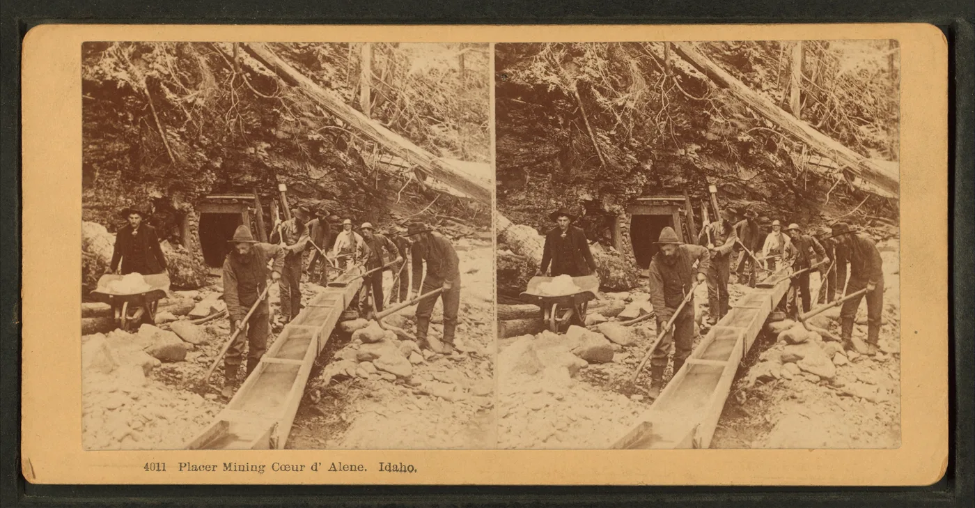
Idaho's mining history begins in 1860, when Elias Davidson Pierce discovered placer gold along Orofino Creek. The rush that followed established mining camps and boomtowns across the Clearwater, Boise Basin and Salmon River country, and later development of the Idaho Batholith's gold-bearing quartz veins and the Coeur d'Alene silver-lead-zinc district built on that early activity for more than a century.
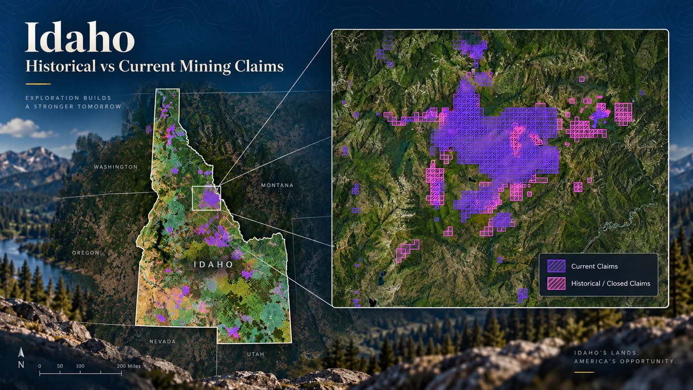
Repeated historical claim activity in a district — a drainage or mountain range claimed and reclaimed across decades — can help researchers identify old mining corridors and areas with a long history of exploration. It does not establish current access, current mineral ownership, mineral potential, or availability for a new claim. That distinction matters most in a state like Idaho, where century-old districts sit alongside modern federal, state and private land designations.
Staked Maps' current-vs-historical claim layer for Idaho. Purple: current claims. Pink: historical/closed claims.Historical mining photograph. Wikimedia Commons, Public Domain. "Placer mining, Coeur d'Alene, Idaho," from the Robert N. Dennis collection of stereoscopic views. Unknown artist. Current location: Stephen A. Schwarzman Building / Photography Collection, Miriam and Ira D. Wallach Division of Art, Prints and Photographs, New York Public Library. This image illustrates historical placer mining generally and is not represented as depicting a specific verified date, mine or claim.
Idaho Mining Regions Worth Understanding
Central Idaho Gold Country
Gold prospecting in Idaho traces back to 1860, when Elias Davidson Pierce found placer gold along Orofino Creek, triggering a rush that established mining camps across the Clearwater, Boise Basin and Salmon River country. Cretaceous granitic intrusion of the Idaho Batholith fractured older metasedimentary and volcanic rock, forming gold-bearing quartz veins that fed placer gravels downstream in the Salmon, Boise and Payette river systems as those veins eroded. Historic placer and lode development across this region underlies much of central Idaho's current claim activity, including Boise, Custer, Valley and Idaho counties.
Silver Valley
Shoshone County's Coeur d'Alene Mining District — commonly known as the Silver Valley — is one of the most significant silver, lead and zinc districts in U.S. mining history. Its long production history is reflected in Shoshone County's current claim data, which remains dominated by lode claims (95.7%).
Lemhi County and the Idaho Cobalt Belt
USGS describes the Idaho Cobalt Belt as a roughly 55-kilometer-long, northwest-trending belt of cobalt (with associated copper) deposits and prospects in the Salmon River Mountains of east-central Idaho, about 10 kilometers wide at its central part. The belt is centered on the Blackbird district in Lemhi County, historically North America's most significant primary cobalt resource. The Idaho Geological Survey's Staff Report T-26-01, a 2026 review of geoscientific studies of the Blackbird district and Idaho Cobalt Belt spanning 1902 to 2024, is the most current published research on the district — see the Idaho Geological Survey link in the official-sources section below rather than relying on older, generic geology summaries.
Southeastern Idaho Phosphate
Southeastern Idaho's open-pit phosphate mines supply approximately 22 to 25 percent of the nation's phosphate, according to BLM. BLM Idaho currently oversees 86 active phosphate leases in eastern Idaho covering a total of roughly 44,000 acres.
Not Everything Mined in Idaho Appears as a Mining Claim
Phosphate is not locatable under the 1872 Mining Law the way lode and placer claims are. It is a leasable mineral, administered through the federal mineral-leasing system rather than ordinary unpatented mining claims. That means Idaho's phosphate production does not show up anywhere in the claim counts on this page — a distinction worth understanding before assuming every commercially significant mineral activity in Idaho is claim-based.
BLM manages nearly 12 million acres of public surface land in Idaho and approximately 36.5 million acres of federal subsurface mineral estate. Those two figures describe different things: the larger mineral-estate acreage extends beneath land whose surface is managed or owned by someone else — the U.S. Forest Service, another federal agency, the State of Idaho, or a private landowner — not just beneath the 12 million acres of BLM-managed surface.
Seeing public land on a map does not, by itself, establish that the land is open to mineral entry.
Seeing no current claim does not mean the ground is available to stake.
Map Concept
What It Tells You
Surface management
Who manages or owns the surface.
Mineral estate
Who owns or administers subsurface mineral rights — not always the same party as surface management.
Mining claim
A federal mining-law record. It is not, by itself, surface ownership.
Withdrawal / restriction
Land may be legally unavailable for mineral entry despite appearing public on a map.
Private property
Access and mineral ownership require separate verification from the landowner.
Use the map to research. Use official records to verify.
Staked Maps helps you see recorded claim activity and land context in one place. It does not make a legal determination that a parcel is open to mineral entry, available for claim location, accessible across surrounding property, or free of other rights and restrictions.
Idaho State Land and Riverbeds Require Different Research
Idaho state endowment land is not simply equivalent to BLM public domain land.
The Idaho Department of Lands (IDL) and the Idaho Land Board have statutory authority to administer mineral leasing on more than 3.4 million acres of state endowment trust land mineral estate. That land is managed for the benefit of Idaho's endowment beneficiaries (primarily public schools), under state leasing rules that are separate from BLM's federal mining-claim system.
Navigable Riverbeds
IDL states that Idaho owns the beds and banks of navigable waterways below the ordinary high-water mark, along with the mineral rights associated with those lands, and that IDL administers riverbed mineral leases and exploration locations.
This matters for prospectors because a river's surface appearance tells you nothing about who holds the mineral rights beneath it. A waterway that looks like ordinary public land can involve state-owned mineral rights subject to IDL leasing and exploration rules — and some waterways have restricted mineral entry. Staked Maps does not make a blanket statement that Idaho riverbeds are open or closed to mineral activity; check current IDL rules for the specific waterway before assuming recreational or commercial mineral activity is permitted.
Before You Dredge or Use Mechanized Mining Equipment in Idaho
Idaho DEQ's Small Suction Dredge General Permit (IDG370000) authorizes discharge from small suction dredges — intake nozzle 5 inches or less in diameter, engine 15 horsepower or less — into eligible waters, and requires operators to be working in a DEQ/EPA-designated open area. Separately, the Idaho Department of Water Resources (IDWR) requires its own Small Scale Mining Authorization for mechanized equipment — suction dredges, powered sluice boxes and high bankers — operating below the ordinary high-water mark, and maintains its own open/closed stream designations. IDWR notes that its open/closed designations and other agencies' designations for the same stream can differ, so a stream that is open under one program is not automatically open under the other — the operator is responsible for confirming both.
Rules vary by stream, equipment and land status. Always check the current agency requirements for the exact location before operating equipment.
Special-area procedures exist beyond the general rules above — for example, IDWR maintains a separate supplemental process for the South Fork Clearwater River and a separate, seasonally limited permitting window for the McCoy Creek drainage. Do not assume the general rules above cover every Idaho stream.
A Verified Idaho Collecting Example: Emerald Creek Garnet Area
The Forest Service identifies the Emerald Creek Garnet Area, on the Idaho Panhandle National Forest, as a public collecting area for Idaho star garnets. Access is by advance reservation only through Recreation.gov — no tickets are sold on site — and the site operates seasonally, roughly Thursday through Saturday from Memorial Day weekend through Labor Day weekend.
This is a useful contrast for understanding the mineral-occurrence data later on this page:
MRDS mineral occurrence: evidence that minerals were recorded at or near a location. It does not, by itself, establish a public right to collect there.
Managed collecting area: a specific agency has established a public collecting opportunity, subject to its own rules, fees and schedule.
Collecting elsewhere on National Forest land is generally handled differently — wilderness areas, cultural or archaeological sites, and any existing mining claim are outside the ticketed Garnet Area program and can carry their own restrictions. Staked Maps has not independently verified access rules for every Idaho collecting location; check current Forest Service information before visiting.
Regulatory content last reviewed September 15, 2026. This date reflects when Staked Maps last checked these sources — it is not updated automatically with each build.
Idaho Rockhounding & Mineral Occurrence Records
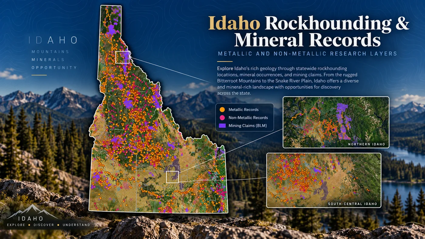
Staked Maps currently contains 7,243 documented Idaho mineral-occurrence / rockhounding research records derived from the USGS Mineral Resources Data System (MRDS) — 6,392 classified as metallic and 851 as non-metallic. USGS describes MRDS as records describing mineral deposits, mines, prospects and occurrences. That makes MRDS useful research data, but it does not establish public access or collecting legality at any given point.
An MRDS Location Is Not a Public Collecting Location
A mineral-occurrence record may represent a deposit, prospect, mine or reported commodity. It does not establish current public access, permission to collect, presence of collectible material today, current mining-claim status, or whether the land is subject to restrictions.
For each location, you still need to research land ownership, active claims, closures or withdrawals, access, and collecting rules.
Staked Maps mineral-occurrence layer over Idaho. These are documented occurrences derived from USGS MRDS, not a guaranteed list of public collecting sites.
Most Common Reported Materials in the Idaho Dataset
Material
Sites Recorded
Fluorite
61
Black Sand
33
Quartz
23
Gemstones
18
Thorium
15
Kyanite
13
How to Research an Idaho Prospecting Area Before You Go
Find the general area and inspect current mining claims. Start with Staked Maps' current federal claim layer to see what's already recorded nearby.
Add surface-management information. Layer in who manages the surface — BLM, U.S. Forest Service, State of Idaho or private — since that alone doesn't tell you who controls the minerals.
Examine historical claims and mineral-occurrence records for context. Prior claim activity and MRDS records can point to areas with a documented mining history, without proving current access or availability.
Check federal and state restrictions, mineral ownership and access. Confirm whether the area involves state endowment mineral rights, navigable riverbed mineral rights, withdrawals, or private property before assuming it's open.
Verify current legal status with the appropriate agency before staking or disturbing ground. BLM, IDL, Idaho DEQ or IDWR — depending on what you're researching — before you stake a claim, dredge, or otherwise disturb ground.
Research counties and historic mining areas before a trip.
Navigate saved map areas in the field with applicable paid features.
Cannot by itself
Prove that land is legally open to mineral entry.
Establish mineral ownership or legal title.
Guarantee that every mapped boundary is survey-grade.
Give permission to cross private property.
Give permission to prospect on someone else's valid mining claim.
Replace current BLM, USFS, state or county records.
Determine which mining or in-stream activities require permits.
Use Staked Maps as a research and navigation tool, then confirm legal status with the agencies that manage the land and mineral estate.
Research Idaho in the Field with Staked Maps
Statewide statistics are useful for understanding patterns, but individual research happens on the map. Staked Maps brings the research on this page together with field-ready tools:
Current federal claim layer — see current BLM claim and site records with available claim details.
Historical claim layer — compare current activity against BLM's closed-claims dataset.
Land / surface-management layers — see who manages the surface alongside claim data, and PLSS reference lines.
Waterways, roads and trails — navigate toward and around a research area.
Mineral-occurrence records — the same MRDS-derived research layer discussed above.
Claim details, custom pins and offline maps — paid plans add claim-number search, full legal descriptions, custom pins, offline map downloads, and Draft A Claim tools for areas where cell service disappears.
Free account · No credit card required · Opens directly to Idaho
How Staked Maps Builds the Idaho Mining Claims Map
A useful mining map needs more than points and polygons. It also needs clear source provenance and an honest explanation of what each dataset can and cannot establish.
Current Mining Claims & Sites
Current federal mining claim and site records in Staked Maps originate from Bureau of Land Management mineral-record data, including the Mineral & Land Records System (MLRS). Staked Maps synchronizes current claim records daily — not in real time with every visit. The separate historical/closed-claims dataset is synchronized on a less frequent schedule.
Current / not-closed is a Staked Maps grouping. Individual BLM status values (Active, Filed, Under Review and others) are retained separately and shown in the status analysis above.
Historical / Closed Claims
Historical records represent claims and sites that are part of BLM's closed-claims dataset. They are useful because previous claim activity can reveal where mineral exploration occurred, but a historical claim does not prove that land is open today or that economically valuable minerals remain.
Mapped Claim Geometry
Staked Maps converts available federal land descriptions and source geometry into map features designed for research and field reference. Mapped claim polygons are not professional cadastral surveys and should not be treated as legal property-boundary determinations. Where exact legal position matters, review the official BLM record and appropriate survey information.
Surface Management & Land Ownership
Land-ownership and surface-management layers help you understand who manages the surface, but surface management alone does not determine mineral ownership or whether land is open to mineral entry. This distinction is especially important in Idaho, where BLM, U.S. Forest Service, State of Idaho, and private ownership of the surface and mineral estate frequently do not line up with each other.
Mineral Occurrences
Staked Maps' mineral-occurrence research layer is derived from the USGS Mineral Resources Data System. MRDS records document mineral occurrences, prospects, mines and reported commodities. They are not a curated list of legally accessible public rockhounding sites.
Idaho Geology & Regulatory Content
Idaho-specific geology and regulatory content on this page relies primarily on the U.S. Geological Survey, the Idaho Geological Survey, BLM, the Idaho Department of Lands, Idaho DEQ, IDWR and the U.S. Forest Service. Regulatory content is reviewed periodically, not continuously; see the dated review notes above each regulatory section.
What Staked Maps Does Not Determine
Staked Maps does not determine:
whether land is legally open to mineral entry
whether a valid mineral discovery exists
mineral value or recoverability
legal mineral ownership, including state endowment or riverbed mineral rights
survey-grade claim boundaries
legal access through private property
permission to work another person's mining claim
whether a specific activity requires DEQ, IDWR, BLM, USFS or IDL authorization
whether a USGS MRDS location is publicly accessible
whether minerals remain at a historical occurrence
Staked Maps is a research and navigation tool. For legal filings and final land-status decisions, verify the current official record with the responsible government agency.
Use for: Current Idaho mining-activity research, including the Blackbird District & Idaho Cobalt Belt review and annual mining-and-exploration reports.
Use for: The current reservation system and rules for the Idaho Panhandle National Forest's managed star-garnet collecting area.
Frequently Asked Questions
Where does Staked Maps get its mining claim data?
Directly from the Bureau of Land Management's official MLRS (Mineral & Land Records System) case-recordation records, synced into our database on a regular schedule — not scraped or crowd-sourced.
Can I search by claim number?
Free users can search by county. Paid plans add search by claim serial number, plus each claim's full legal (aliquot) description and BLM records link.
How many active mining claims are in Idaho?
As of September 24, 2026, BLM records in Staked Maps show 21,687 Idaho mining claim and site records with a case disposition of Active. Another 2 are Appeal - Stay Granted, 220 are Under Review, 19,396 are Filed and 1 is Submitted, bringing Idaho's total current/not-closed federal claim and site records to 41,306. These database statuses are not a legal determination that an individual claim contains a valid mineral discovery.
What are Rockhound Hotspots?
A premium map layer of documented mineral occurrences, prospects and mines sourced from USGS MRDS and labeled by material where available. These records are research leads, not a directory of verified public collecting sites.
Where are most mining claims in Idaho?
Idaho's current federal mining-claim records are concentrated in a handful of counties. As of the data date above, Lemhi County ranks first, followed by Washington County and Shoshone County. Together, those counties account for about 45% of Idaho's current mapped claim/site records. Claim concentration indicates recorded mining activity, not whether adjacent land is open for prospecting or whether it has mineral potential.
Does the Idaho map cover the whole state?
Yes. Staked Maps covers Idaho statewide. Dedicated research pages are currently available for Owyhee County, Custer County, Idaho County, Shoshone County and Lemhi County, while the interactive map covers claims and surface management throughout Idaho.
Which agency manages federal mining claims in Idaho?
The Bureau of Land Management manages federal mining-claim records in Idaho through the Mineral & Land Records System and its Idaho State Office. The Idaho Department of Lands separately administers mineral leasing on state endowment trust land and navigable riverbeds, and Idaho DEQ and IDWR administer permits for mechanized prospecting equipment.
Which Idaho counties have the most Active mining claims?
By BLM-status Active records specifically, Lemhi County ranks first (4,724), followed by Shoshone County (2,949) and Valley County (2,623). This differs from the ranking by the broader current/not-closed total (which also includes Filed and Under Review records), where Washington County ranks second overall but seventh by Active records alone — see the Active-records table earlier on this page.
Does an area with no mining claim shown mean it's open for staking in Idaho?
No. An area with no current claim displayed may still be unavailable because of mineral ownership, surface-management restrictions, withdrawals, state endowment or riverbed mineral rights, or other restrictions. A blank area on the map is a place to research further, not proof of open ground.
What is the difference between current and historical mining claims in Idaho?
Current/not-closed records are on the current side of Staked Maps' federal-record dataset for Idaho. Historical records come from BLM's separate closed-claims dataset. Historical records can help identify previously active mining districts, but they do not prove that land is open to a new claim today.
Can you suction dredge for gold in Idaho?
Mechanized stream activity in Idaho can require both an Idaho DEQ Small Suction Dredge General Permit (water-quality discharge) and an IDWR Small Scale Mining Authorization (stream-channel alteration), and DEQ's and IDWR's open/closed stream designations do not always match each other. Some streams also have special-area procedures. Verify both agencies' current requirements for the exact location before operating equipment.
Are Idaho riverbeds BLM land?
Not necessarily. Idaho owns the beds and banks of navigable waterways below the ordinary high-water mark, along with the associated mineral rights, administered by the Idaho Department of Lands. That is a separate mineral-rights framework from BLM's federal claim system, and some waterways have restricted mineral entry.
What are Staked Maps' Idaho rockhounding records?
They are mineral-occurrence records derived from the USGS Mineral Resources Data System (MRDS), showing where minerals, prospects or mines have been documented historically. They are research leads, not a directory of verified public collecting sites.
Are Staked Maps' Idaho mining-claim boundaries legal surveys?
No. Staked Maps claim geometry is designed for research and field reference and should not be treated as a professional cadastral survey or legal boundary determination. Review official BLM records and appropriate survey information when exact legal position matters.
How often is Idaho mining-claim data updated?
Staked Maps synchronizes Idaho's current federal claim dataset from BLM daily, not in real time with every visit. The separate historical/closed-claims dataset is synchronized on a less frequent schedule. The data-synchronization date shown on this page reflects the most recent completed sync, not the moment you're viewing the page.
Single State, Tri-State and All-West all unlock the exact same features — nothing is pay-gated between them, they differ only in how many states you get.
Paid plans renew automatically at the monthly or annual rate you choose until you cancel. Cancel anytime and keep access through the end of your paid period. See our Terms of Use.
Single State, Tri-State and All-West unlock the identical feature set — only the number of states differs.
National Rockhound Pass is a separate, nationwide-but-lighter product built for rockhounds outside the core mining states.
Free
Single State
Tri-State
All-West
Rockhound Pass
Geographic coverage
1 state (view only)
1 state, full data
3 states, full data
13 Western states, full data
All 50 states, safety layer only
Interactive claims map, basemaps, compass, county search
✓
✓
✓
✓
✓
Surface management (public/private land) overlay
✓
✓
✓
✓
✓
Claim type, name, status & size in popups
✓
✓
✓
✓
✓
Full legal location (aliquot description)
✕
✓
✓
✓
✕
Claim serial number, owner intel, BLM Records & 'Directions' button
✕
✓
✓
✓
✕
Search by claim number
✕
✓
✓
✓
✕
Custom pins & distance measure tool
✕
✓ (up to 50)
✓ (up to 50)
✓ (up to 50)
✓
Expired & historical claims layer
✕
✓
✓
✓
✕
Placer/Lode claim filters & latest synchronized data
Information hosted on Staked Maps is compiled from publicly available data
streams provided by the Bureau of Land Management (BLM) and relevant state
geographic clearinghouses. Staked Maps accepts no liability for the content of
this geospatial data, or for the consequences of any real-world exploration,
land entry, or staking actions taken on the basis of the information provided
via this application interface.
Staked Maps makes no warranty, expressed or implied, including the warranties of
merchantability and fitness for a particular purpose, nor assumes any legal
liability or responsibility for the pinpoint accuracy, reliability, completeness,
latency, or programmatic utility of these geospatial data layers, or for the
improper interpretation of these data grids.
These mapping layers and related graphics are visual convenience aids only; they
are not legal documents and must never be used as such. The data may not be used
to legally determine title, mineral ownership, valid description boundaries,
jurisdictional authorities, or land restrictions in place on public or private
land. Natural backcountry hazards may or may not be depicted on topographies, and
land users are strictly mandated to exercise caution. Federal records are dynamic
and change constantly. The end-user is exclusively responsible for validating
current land classifications with local BLM field offices and managing compliance
accordingly.